 1
Historic center
Arco da Vila and Vila-Adentro
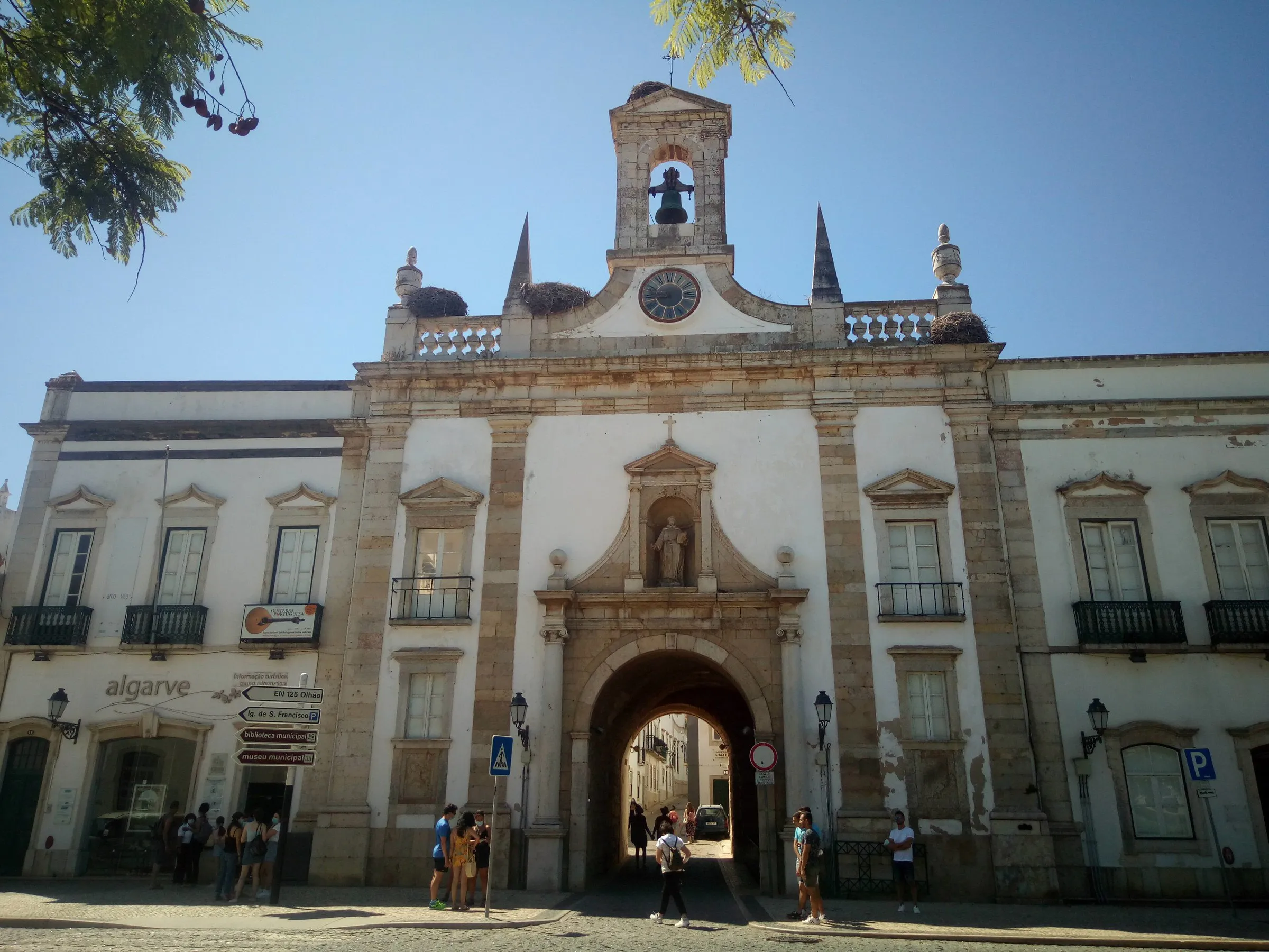
Neoclassical gate opened in 1812 that leads into Vila-Adentro, Faro's walled old town. At the top, storks have kept a nest for years.
View details for Arco da Vila and Vila-Adentro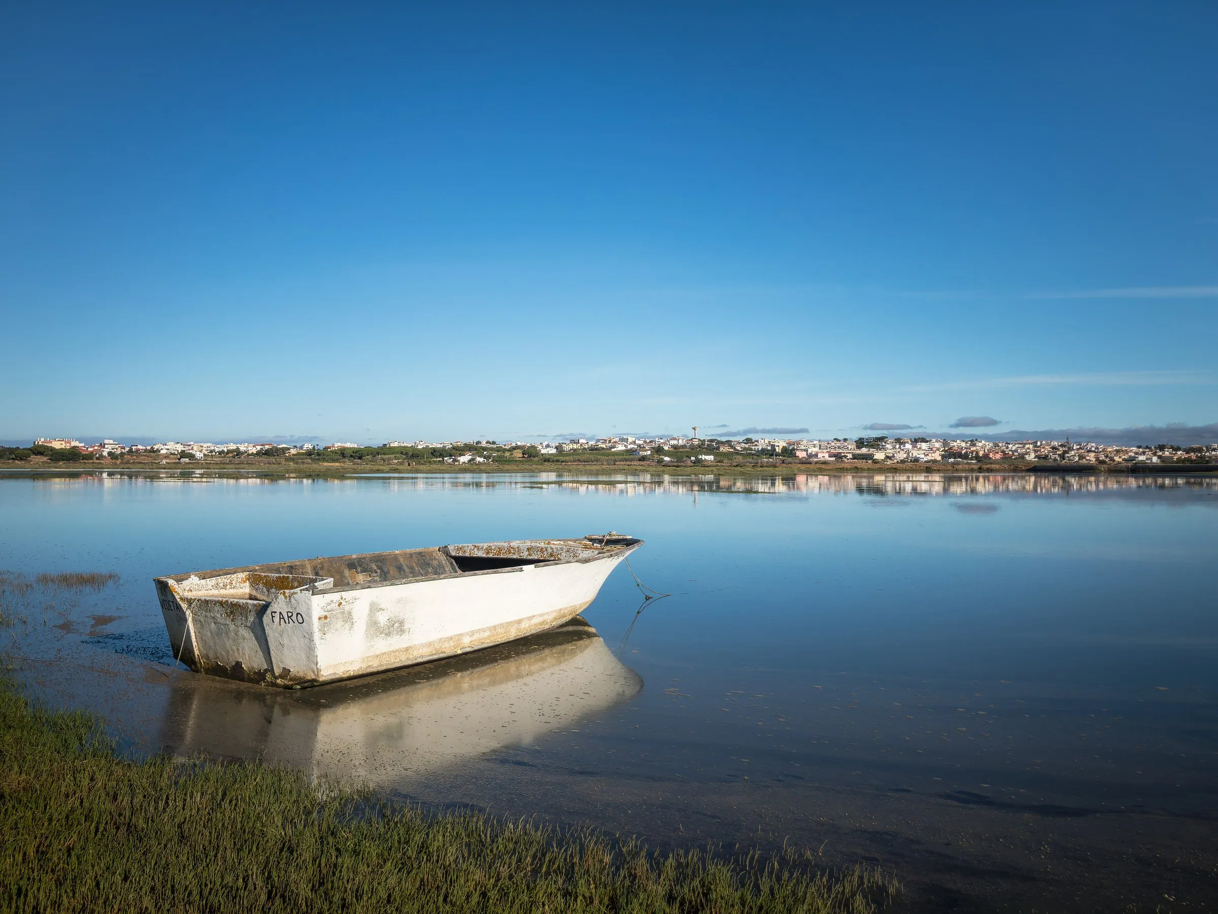
Portugal
In Faro, storks nest on top of the arch that opens the old town, and the boat to the islands leaves from the center. Past the wall, the Ria Formosa begins, with salt pans, channels and sandbars.
Plenty of people know Faro only from the airplane window and head straight from the airport to another Algarve beach. A miscalculation. The Algarve's capital, the southernmost city in mainland Portugal, keeps a quiet old town inside its walls, with a cathedral, a convent and storks perched on top of the gates. On the other side of the stone lies the Ria Formosa, a lagoon of channels, salt pans and sand islands where the boat does the job of the bus.
This guide uses Faro as a base and goes beyond the city limits. Ilha Deserta, Culatra and Estoi belong to the municipality of Faro, but they lie outside the center, a boat crossing or about 10 km by road away. Olhão, Loulé and Tavira are neighboring towns, good for day trips by train, bus or car. Benagil and Ponta da Piedade, in the western Algarve, come in as a two-day extension, with an overnight stay in Lagos.
The first days are on foot and by boat: Vila-Adentro fits into a morning, and the ria deserves a full day. After that, alternate markets, Roman ruins and island beaches. Faro has the airport, the train station and the boat dock all in one place, so you can build five days without changing hotels and only repack for the extension.
The southernmost point of mainland Portugal is not Sagres: it is Cabo de Santa Maria, on Ilha da Barreta, which belongs to the municipality of Faro.
Faro became the administrative seat of the Algarve in 1756, the year after the great earthquake, taking over the role that had belonged to Lagos.
In the 1755 earthquake, the Ria Formosa's sand islands helped protect Faro from the tsunami that devastated other towns on the Algarve coast.
In Roman times, Faro was called Ossonoba. Under Muslim rule, it was known as Santa Maria Ibn Harun.
1Neoclassical gate opened in 1812 that leads into Vila-Adentro, Faro's walled old town. At the top, storks have kept a nest for years.
View details for Arco da Vila and Vila-Adentro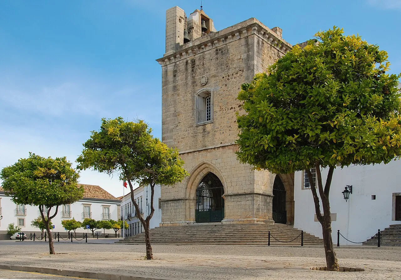 2
Cathedral begun in 1251, soon after the Christian reconquest, with a Baroque interior, 17th-century tiles and a tower overlooking the Ria Formosa.
View details for Faro Cathedral (Sé de Faro)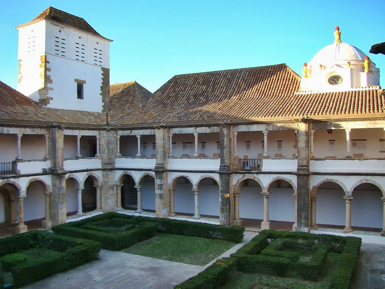 3
Former 16th-century Renaissance convent built around a cloister, home to the Roman mosaic of the god Oceanus, classified as a national treasure.
View details for Faro Municipal Museum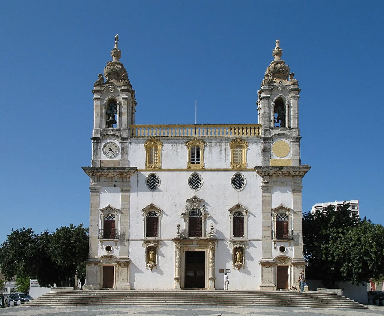 4
18th-century Baroque church with two towers on its facade and, at the back, the Chapel of Bones, from 1816, with walls lined with bones and over a thousand skulls.
View details for Carmo Church and Chapel of Bones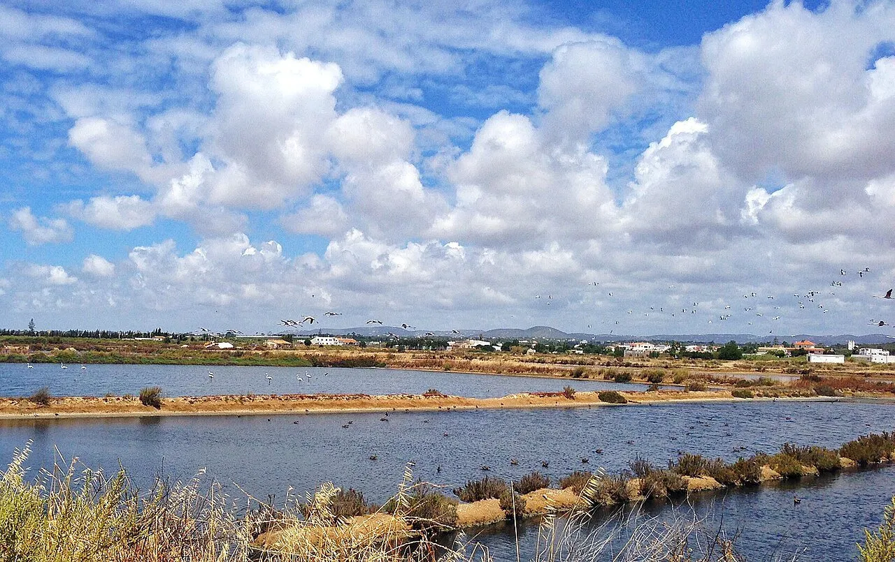 5
Lagoon of about 60 km sheltered by barrier islands, starting at Faro's doorstep and stretching across several municipalities. Boat tours leave from the center.
View details for Ria Formosa Natural Park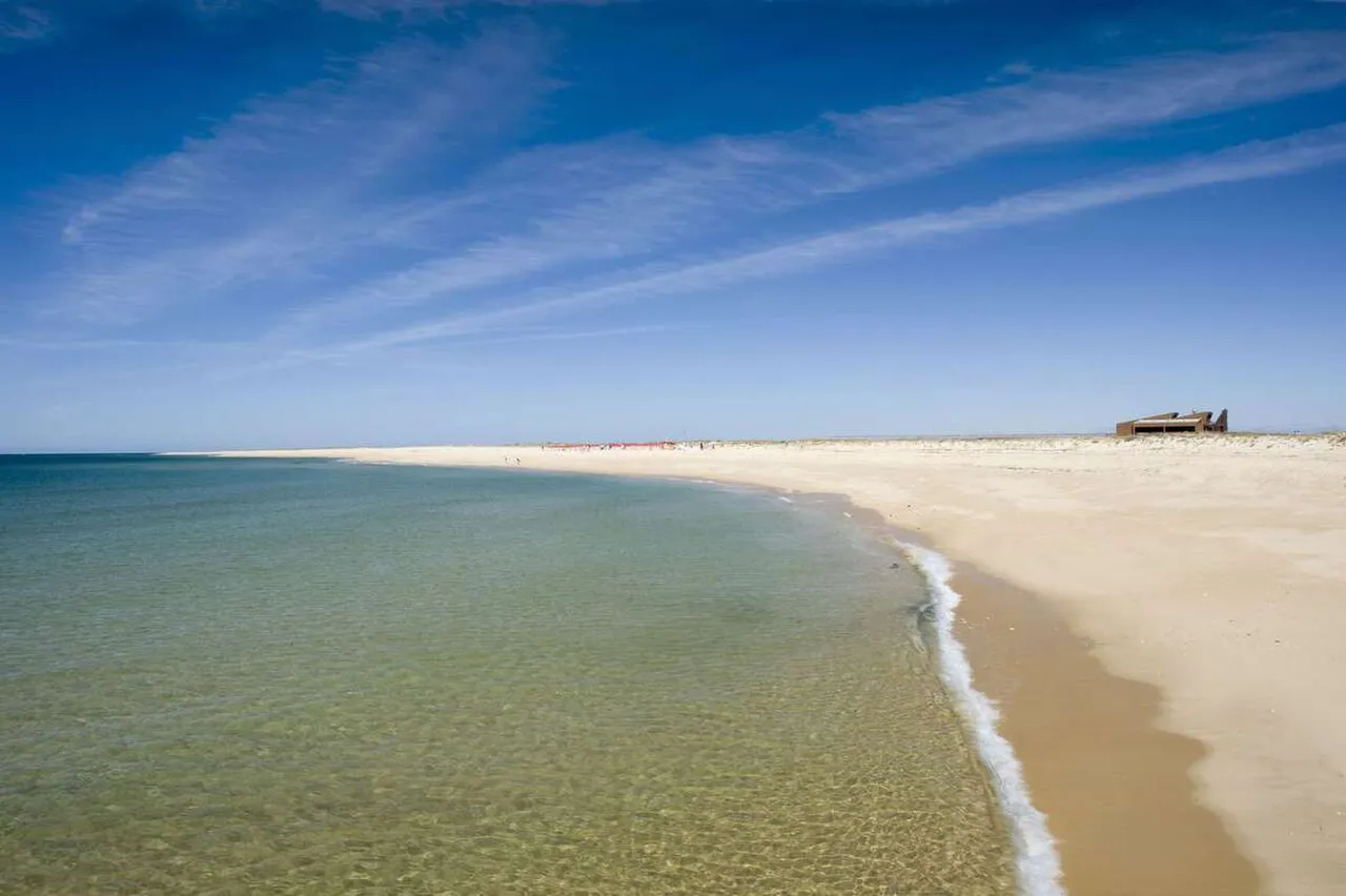 6
Sand island with hardly anyone on it, in the municipality of Faro, a boat crossing from the center. Boardwalks lead to Cabo de Santa Maria, the southern tip of mainland Portugal.
View details for Ilha Deserta (Ilha da Barreta)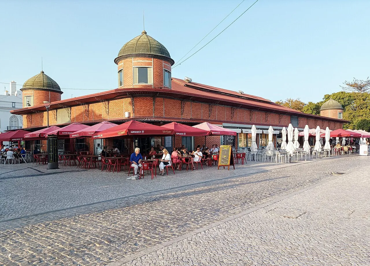 7
Two exposed-brick pavilions with towers and domes, opened in 1916 on the edge of the ria, in Olhão, a town next to Faro. One sells fish; the other, vegetables.
View details for Olhão Markets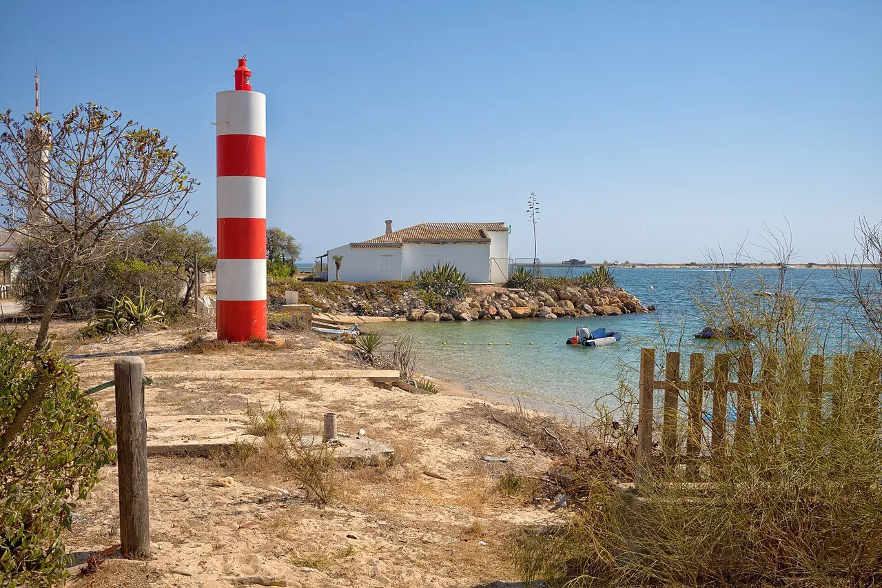 8
Car-free island in the Ria Formosa, with three settlements and the Santa Maria Lighthouse at its western tip. It belongs to Faro, but the most used boat leaves from Olhão.
View details for Ilha da Culatra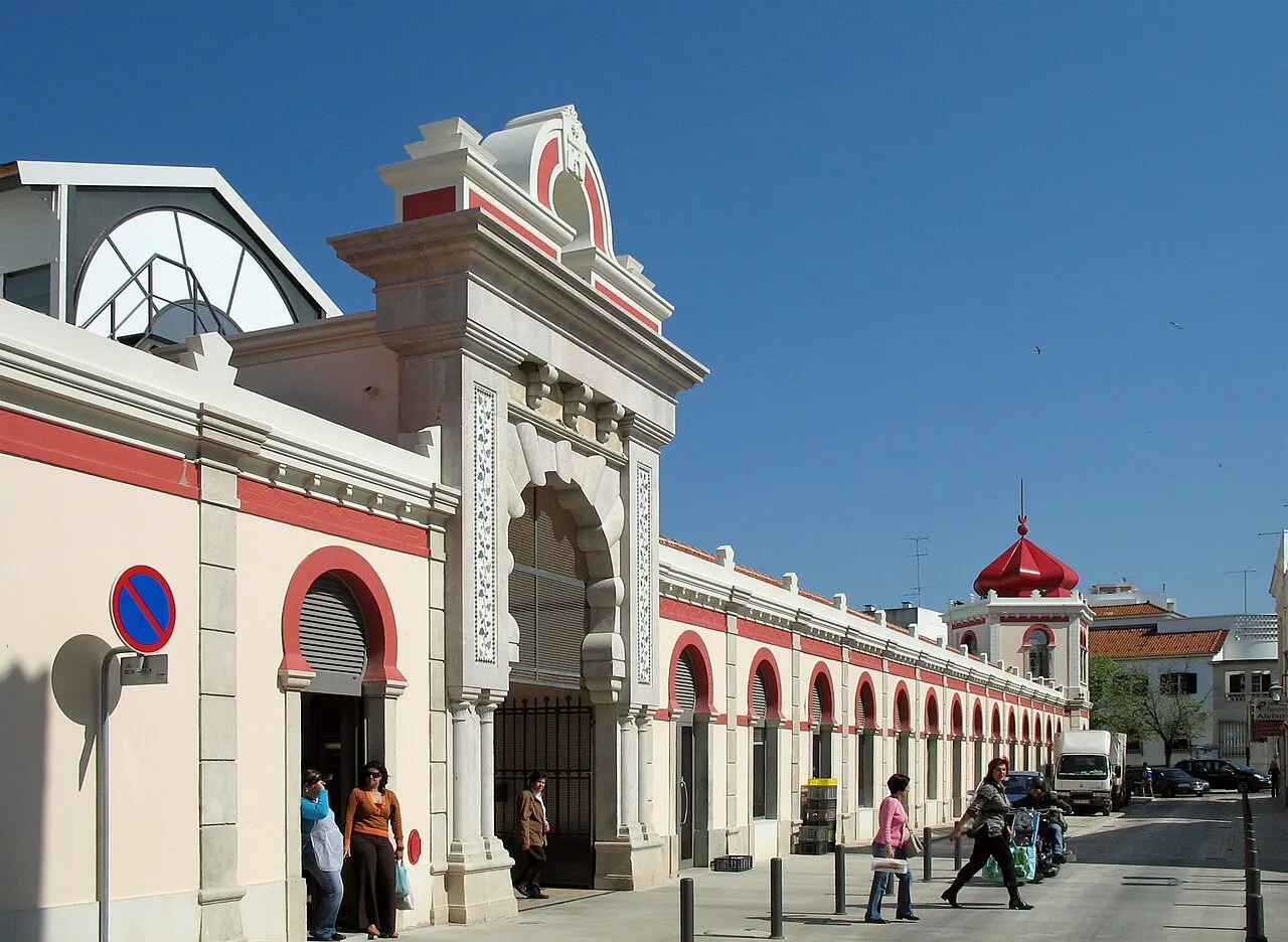 9
1908 market in Neo-Moorish style, with domes at the corners, in the town of Loulé, about 16 km from Faro. On Saturdays, a fair also takes over the surrounding streets.
View details for Loulé Municipal Market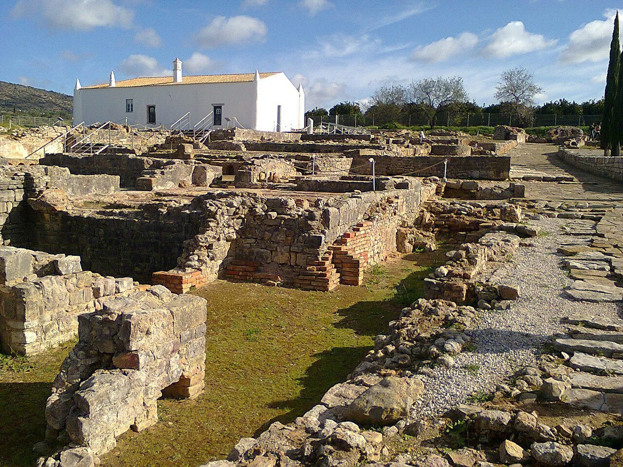 10
Roman villa in Estoi, about 9 km from central Faro, occupied from the 1st to the 10th century, with fish mosaics in the baths and the ruins of a water sanctuary.
View details for Milreu Roman Ruins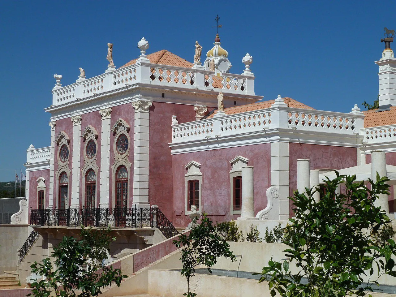 11
Pink palace completed in 1909 in Estoi, about 10 km from central Faro, with three-level gardens, statues and tile panels. Today it is a pousada.
View details for Estoi Palace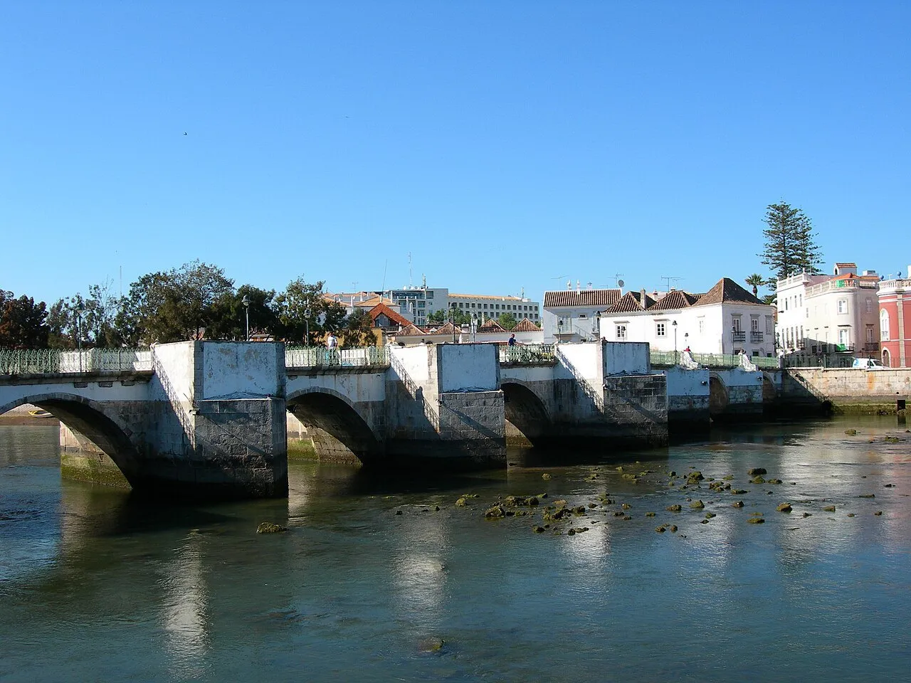 12
Town on the banks of the Gilão River, about 35 minutes by train from Faro, with a bridge of Moorish origin, a hilltop castle and a reputation for having more than 30 churches.
View details for Tavira Historic Center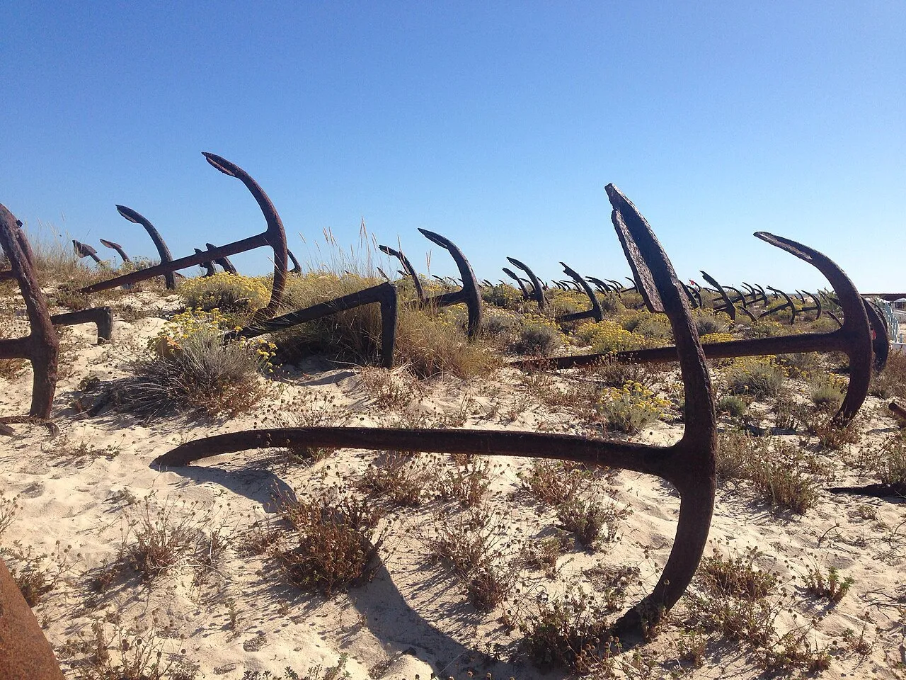 13
Beach on Tavira Island, near Santa Luzia, with a cemetery of more than 200 anchors in the dunes, a reminder of tuna fishing. Reached on foot or by little train.
View details for Praia do Barril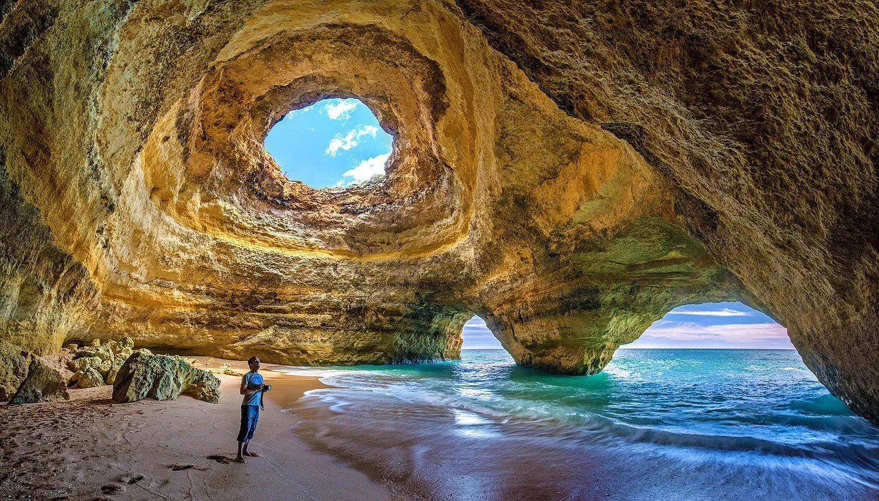 14
Sea cave with an opening in the ceiling that lights a hidden little beach, on the Lagoa coast, about 60 km from Faro. Visited only by water, under strict rules.
View details for Benagil Sea Cave (Algar de Benagil)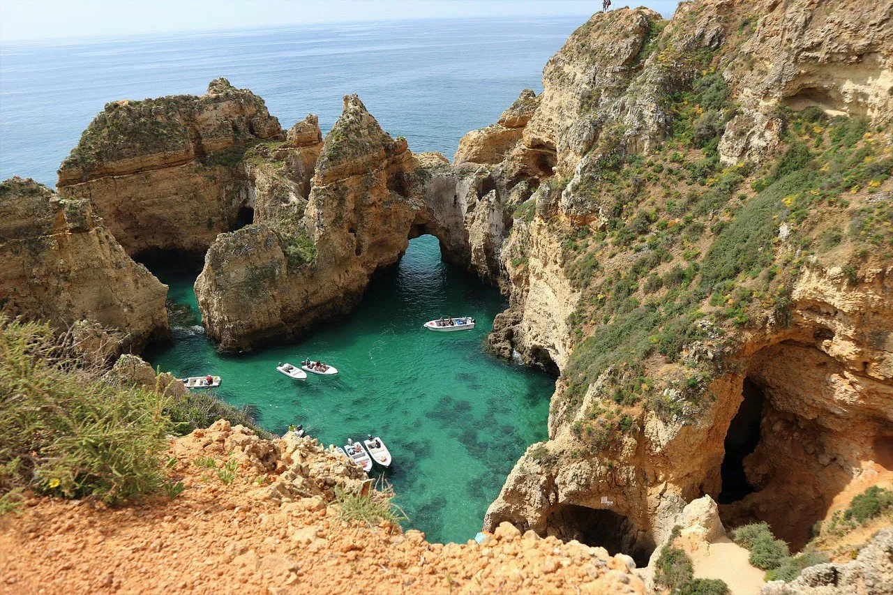 15
Cliffs, arches and caves on the edge of Lagos, in the western Algarve, with a staircase down to the sea and boat tours. Given the distance from Faro, it calls for an overnight stay in Lagos.
View details for Ponta da Piedade1Look up before you walk through: for years, pairs of storks have nested on top of the Arco da Vila, and they tend to get more photos than the architecture itself. The gate was commissioned by Bishop Francisco Gomes do Avelar from the Italian architect Francisco Xavier Fabri and opened in 1812, during the rebuilding that followed the 1755 earthquake.
As you pass through, notice what was left hidden behind the classical facade: a horseshoe arch from the Islamic period, a remnant of the city's old gate. From there begins Vila-Adentro, the walled core of Faro, with cobbled streets, low houses and a silence that surprises anyone just out of the bustle of the Baixa. You can see it all in an unhurried morning.
2The Sé tells Faro's story in layers. Construction began in 1251, two years after Afonso III took the city from the Moors, on a site that, according to tradition, once held a mosque. In 1577, when the bishopric moved from Silves to Faro, the church became a cathedral. Then came the sacking by the Earl of Essex's English troops in the late 16th century and the 1755 earthquake, and each blow left a patch from another era.
Inside, the Baroque rules, with 17th-century tiles and a historic 18th-century organ. The best part, though, is up high: from the tower you see the rooftops of Vila-Adentro, the salt pans and the ria's sandbars all the way to the sea.
3Plenty of people walk past the door of this convent without knowing that inside is the face of a Roman god. The Oceanus mosaic, made between the 2nd and 3rd centuries, first appeared in 1926 on a street in central Faro, was rediscovered and lifted in 1976, and is now the museum's signature piece, classified as a national treasure.
The building is the former Convent of Nossa Senhora da Assunção, a 16th-century Renaissance structure arranged around a cloister. Besides the mosaic, the collection includes Roman busts, such as that of Emperor Hadrian, inscriptions from ancient Ossonoba, a room devoted to the Islamic period and paintings from the 16th to the 19th centuries. On a hot day, the cloister alone is worth it: shade, cool stone and silence.
4The facade already announces the ambition: two symmetrical towers and a Baroque design that looks like a big altarpiece turned toward the street. The church of the Third Order of Carmel was founded in the early 18th century, and the interior goes all out on gilded woodwork.
The reason for the line, though, is in the backyard. The Chapel of Bones, opened in 1816, measures about 4 by 6 meters and has walls covered with the bones of more than a thousand Carmelite friars, with 1,245 skulls in the most commonly cited count. At the entrance, an inscription warns bluntly: "Stop here and consider that to this state you will come." It works better than any sign asking for silence.
5Seen from the wall, the Ria Formosa looks like a board of shallow water, mud, salt pans and channels that redraw themselves with every tide. It is about 60 km of coast, from the Ancão peninsula to Manta Rota, shielded from the Atlantic by a row of barrier islands and peninsulas. The area has been protected since 1978, became a natural park in 1987 and, in 2010, joined the list of the 7 Natural Wonders of Portugal.
Faro is just one of the gates: the ria continues through Olhão and Tavira and reaches the municipalities of Loulé and Vila Real de Santo António. From the center, boat tours run through the channels, good for watching migratory birds and understanding the ebb and flow of the tide. Among the eelgrass lives the seahorse, the symbol of the ria, but don't count on it for the photo.
6Anyone who thinks the southern tip of mainland Portugal is at Sagres gets a surprise here. The southernmost point is Cabo de Santa Maria, on Ilha da Barreta, which everyone calls Ilha Deserta. Don't expect a monument: a wooden sign and a lot of empty beach mark the spot, which suits the island's nickname.
The boat leaves from the Portas do Mar dock in central Faro. The regular ferry takes about 40 minutes across the ria, and faster launches are available. From the landing, wooden boardwalks cross the dunes for a little over 3 km to the cape. Praia da Barreta has a reputation for the warmest water in the country, which, in the open Atlantic, is quite a compliment.
7Olhão is a different town, next to Faro and about 10 minutes away by train, and the market is the best reason to get off at the station. There are two twin buildings of brick and iron, with round turrets and metal domes at the corners, built from 1912 and opened in 1916, right where the historic center meets the Ria Formosa.
One pavilion is for fish and the other for vegetables, and the split makes perfect sense once you step into the first: crushed ice, vendors' calls, stalls laden with what the ria and the sea delivered that dawn. The complex is classified as a monument of public interest. Come in the morning, when the place truly works, and leave the afternoon for the islands.
8On Culatra, traffic means wheelbarrows, bicycles and barefoot people. The island is about 6 km long and has some 700 residents split among three settlements: Farol, Hangares and Culatra. Cars can't get here, and that is precisely the appeal: low houses, fishing nets and sand paths that end at the sea.
On paper, the island belongs to Faro, but the most used boat connection leaves from Olhão, with stops at Farol and Culatra; there are also boats leaving from Faro. Get off at Farol to see the Santa Maria Lighthouse on the western tip and cross over to the beach on the ocean side. The return can leave from the other village, as long as the boat schedule works.
9From a distance, the Loulé Market looks like it crossed the Mediterranean by mistake. Opened in 1908 and designed by Alfredo Costa Campos, it has Arab-inspired styling, four pavilions at the corners and four gates, one on each side. The renovation completed in 2007 modernized the interior and kept the silhouette of domes that became the town's symbol.
Inside, the stalls gather fish, fruit and regional products, and the bustle starts early. Saturday is the busiest day: a producers' fair fills the streets of the center and another, bigger one sets up on the edge of town. Loulé is a different municipality, about 16 km from Faro; by car the trip is short, and there are regular buses between the two towns.
10Milreu shows that the Algarve was already a sought-after address long before beach hotels. The Roman villa was occupied from the 1st century to the 10th and identified by the archaeologist Estácio da Veiga in 1877. In the baths, mosaics with fish still decorate the floor, as if the owner wanted to bring the sea into the bath.
Next to the residence stand the remains of a temple dedicated to a water deity, later turned into an early Christian church, with a baptismal pool. The visitor center has a model of what the temple looked like. Estoi belongs to the municipality of Faro, but lies outside the urban area, about 9 km away: go by car or taxi and combine it with the palace, in the same village.
11Estoi Palace took more than half a century to finish. Work began in the 1840s under Fernando de Carvalhal e Vasconcellos, who died in 1847; the property passed through other hands until it was bought in 1893 by José Francisco da Silva, who completed it in 1909. The result mixes Italian Baroque, Rococo and touches of Art Nouveau, all painted in a pink you won't forget.
The best part is outside. The gardens descend in three levels, with statues, busts, a Carrara marble fountain and tile panels in bright colors and in blue and white. Since 2009 the palace has operated as a pousada, and the visiting rules for non-guests may change.
12Tavira lies about 28 km from Faro, and the train handles the day trip in just over half an hour. The town is organized around the Gilão River, crossed by the so-called Roman Bridge, which is Roman in nickname only: an archaeological survey pointed to a 12th-century Moorish bridge, rebuilt later.
Climb up to the castle and the Church of Santa Maria do Castelo, built on an old mosque. There lies the tomb of Dom Paio Peres Correia, who took the town from the Moors in 1242. Tavira is said to have 37 churches, many rebuilt after 1755, and belongs to the Cittaslow network of unhurried towns, which explains the pace of the streets. A lunch by the river rounds off the morning nicely.
13Rows of rusty anchors, planted in the dunes as if awaiting the next fishing season: it's the first thing you see on arriving at Praia do Barril. They come from the old tuna fishery that operated here and was abandoned in the 1960s, when the fish became scarce. There are more than 200, and the storms of 2018 disturbed part of the alignment.
The beach is on Tavira Island, in the municipality of Tavira, near Santa Luzia. From Pedras d'El Rei, a few kilometers from the center of Tavira, a floating bridge crosses the ria; after that it is about 1.5 km on foot or by little train to the sand. For those coming from Faro, it can be combined with Tavira on the same day, using a short taxi ride between the town and Pedras d'El Rei.
14The image everyone has seen, with light pouring through a hole in the cave ceiling onto a hidden little beach, is the Algar de Benagil, on the Lagoa coast. The sea and the rain carved the rock from the sides and from above until they opened this natural skylight. It lies about 60 km from Faro, some 45 minutes by car; by public transport, the trip takes more than two and a half hours.
Since August 2024, CCDR Algarve rules prohibit landing or using the sand inside the algar, arriving by swimming or with floats, and renting a kayak without a guide in the area. In practice, the visit is by boat or guided kayak, looking from inside the vessel for a short time. Many tours leave from Benagil beach itself, where parking in summer takes patience.
15From above, Ponta da Piedade looks like a sandcastle the sea decided to sculpt: limestone cliffs up to about 20 meters high, arches, pillars and caves that boatmen have nicknamed the camel, the sphinx and the kissing couple. It is in Lagos, in the western Algarve, too far from Faro to fit into a day already full of other outings.
A staircase of about 180 steps goes down to near the water, and the climb back up exacts its price. Boat tours leave from Lagos and last from one hour to an hour and a half, entering the caves when the sea allows. From central Lagos you can walk there in about 30 minutes. From Faro, the train takes close to 1h40, which is why we suggest sleeping a night in Lagos.
The Algarve Line connects Faro to Olhão, Tavira and Lagos. For Estoi, Loulé and Benagil, a rental car for a day or two saves a lot of time.
The airport is about 6 km from the center, with a city bus and taxis. You can arrive in the morning and have lunch in Vila-Adentro.
The ria's islands depend on boats with different timetables in summer and winter. Photograph the schedule at the dock and respect the last boat back.
There is almost no shade on the islands and the wind is deceptive: the heat doesn't feel strong, but your skin does. A hat, sunscreen and a water bottle go in the backpack.
The Olhão and Loulé markets open early and close in the early afternoon; the Loulé one is open Monday to Saturday. Sunday is not a market day.
Several monuments in the region, such as Milreu, usually close on Mondays. Use that day for the beach or a boat.
In Faro, the food comes from the ria and the sea, and the menu follows what the boats brought in. Shellfish, clams and grilled fish dominate the tables near the dock and the old town. For dessert, the Algarve's other side appears, the one of almond trees, fig trees and egg sweets born in convents.
Shellfish and fish cooked in the pan of the same name, which closes like a clam and only opens at the table, releasing steam in the face of whoever ordered it.
Creamy cornmeal porridge with conquilhas, small mollusks from the coast, and sometimes bacon. Algarve home cooking.
Sweet of egg threads, almond and cinnamon, created in Lagos and now protected as Dom Rodrigo do Algarve.
It has no cheese at all: it is a paste of dried fig, almond and sugar, sometimes with a touch of medronho brandy.