 1
Architecture and villages
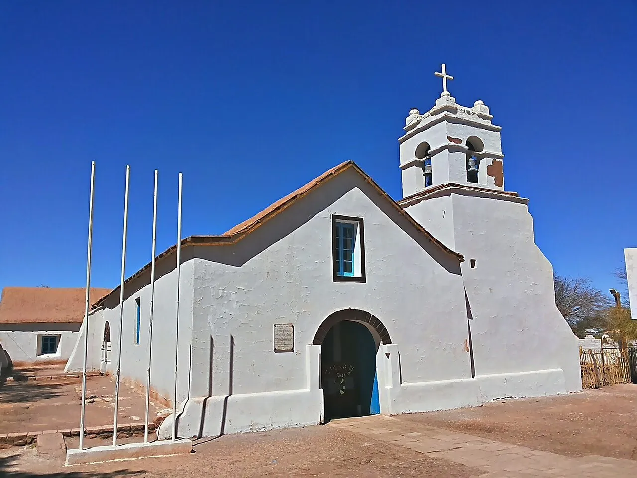
San Pedro de Atacama Church
Beside the village square, the stone and adobe church offers small-scale architecture before the great horizons of the desert.
View details for San Pedro de Atacama Church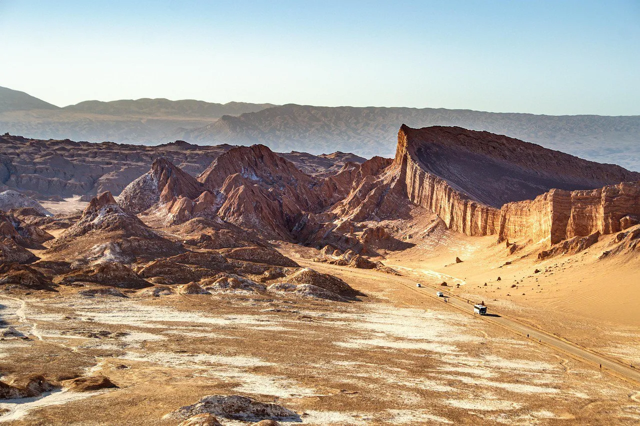
Chile
You leave a dirt street lined with adobe houses and, a little later, you are standing in front of a salt valley. In San Pedro de Atacama, your bag holds a swimsuit and a jacket for the small hours.
San Pedro de Atacama has low adobe houses, dirt streets and a knack for making you check the weather forecast for very different places on the same day. The base is in the Antofagasta Region, in northern Chile, surrounded by deserts, salt flats and mountains. In the center, everything is within walking distance; in the surroundings, transport comes into play. Choosing excursions by the direction of the road keeps the trip from turning into a collection of returns to the same crossroads.
This guide combines the village with excursions to the valleys, the Salar de Atacama and the altiplano. It covers six full days, with arrival the day before: start with the lower-lying surroundings and save the big climbs for later. The church and Quitor help you understand the human presence in this territory, which also belongs to the Lickanantay communities. The outside visits proposed are day trips from San Pedro; the day of the lagoons and Piedras Rojas is reserved entirely for the road and the landscape.
The white of the Valle de la Luna also comes from salt: a landscape that looks like another planet is made of very earthly materials.
On the tour sold as Laguna Cejar, the water open for swimming is in the neighboring Laguna Piedra; Cejar is for looking.
In Toconao, the bell tower of the San Lucas church stands apart from the temple: the tower got its own space on the square.
1Beside the village square, the stone and adobe church offers small-scale architecture before the great horizons of the desert.
View details for San Pedro de Atacama Church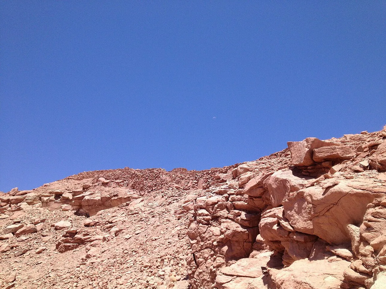 2
Outside the center, the stone fortress sits on a hillside in Quitor and lets you learn part of Lickanantay history without leaving the nearby surroundings.
View details for Pukará de Quitor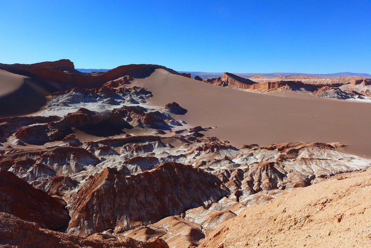 3
Dunes, ridges and salt formations make up a trip in the San Pedro surroundings where the light changes the color of the landscape through the afternoon.
View details for Valle de la Luna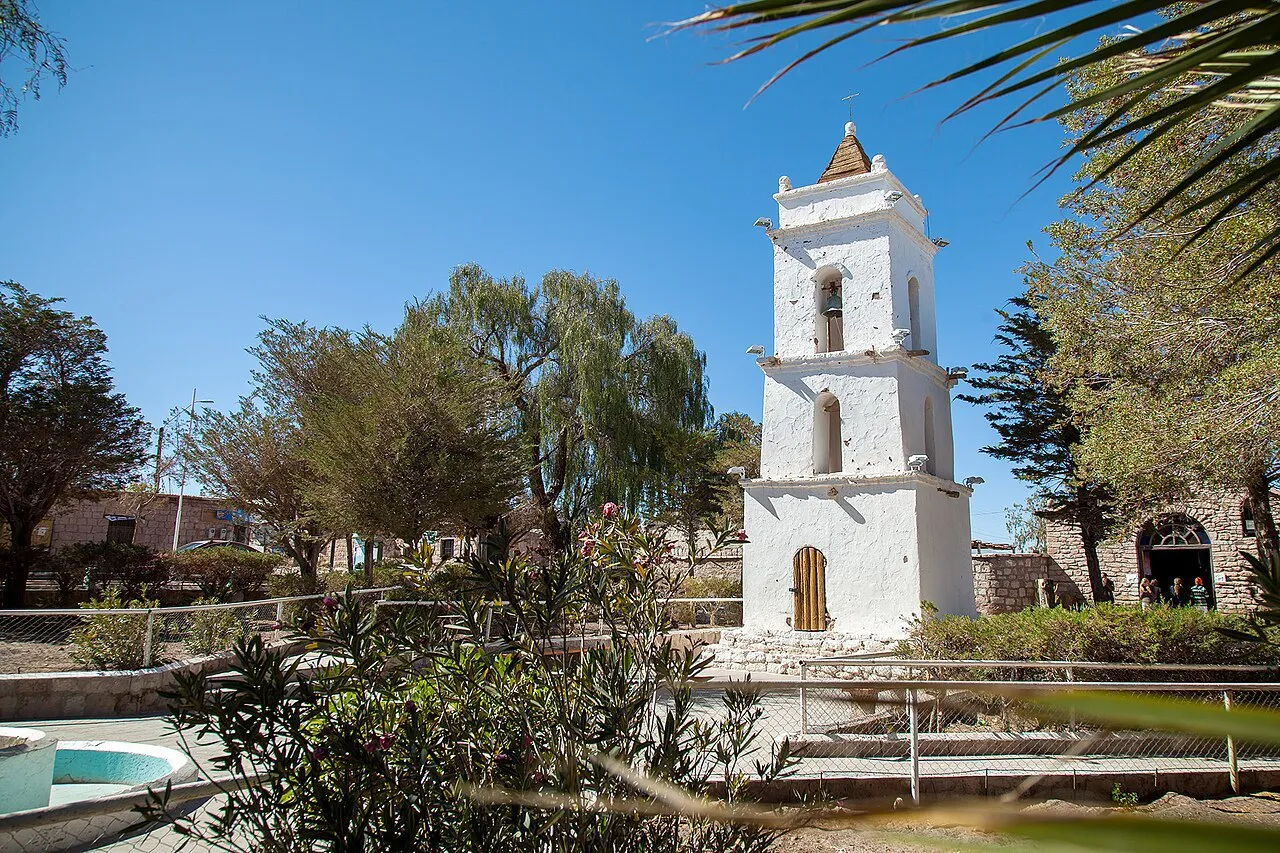 4
South of San Pedro, the village of Toconao has a bell tower separate from the San Lucas church and a long relationship with the oasis crops.
View details for Toconao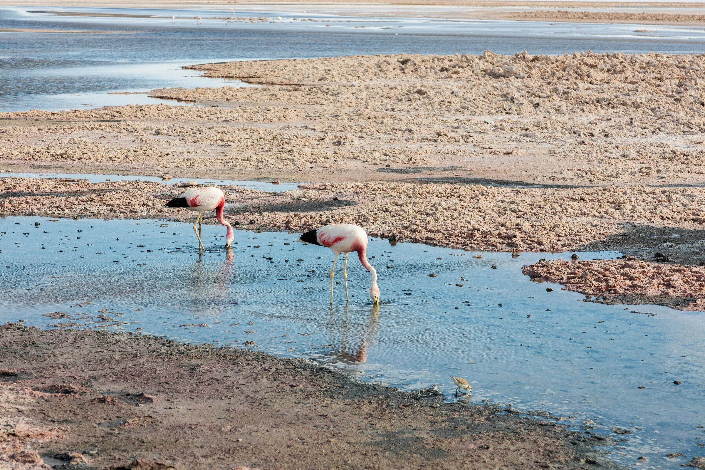 5
On the Salar de Atacama, away from San Pedro, Laguna Chaxa combines salt crusts, shallow water and flamingo watching in the Soncor sector.
View details for Laguna Chaxa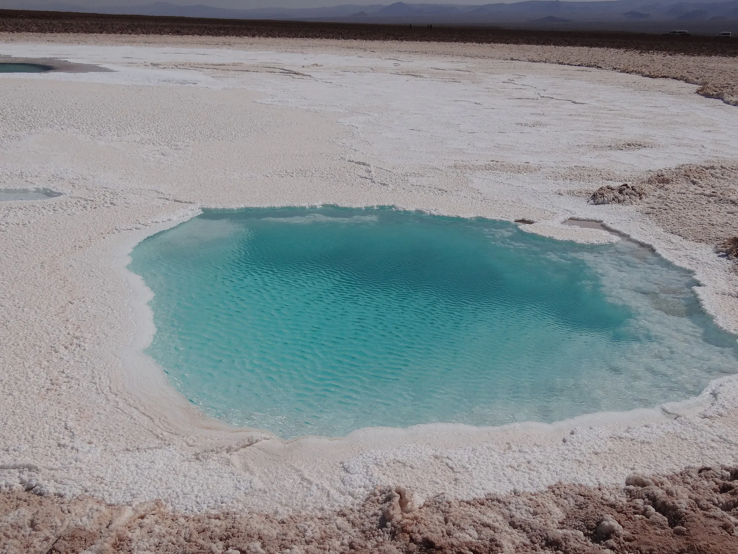 6
In the surroundings of San Pedro, Baltinache's turquoise waters appear between pale salt edges; the proposed outing is for contemplating the landscape.
View details for Hidden Lagoons of Baltinache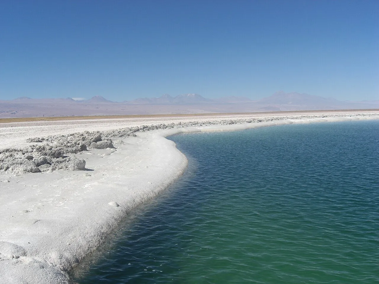 7
On the Salar de Atacama, the Cejar and Piedra pair offers views of the salt landscape and controlled swimming only in the lagoon enabled by the administration.
View details for Cejar and Piedra Lagoons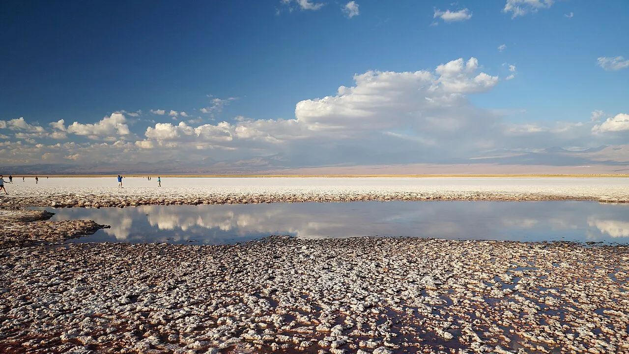 8
Away from San Pedro, Tebenquiche combines brackish water, pale salt and open horizons on a contemplative outing that fits into the same circuit as Cejar.
View details for Laguna Tebenquiche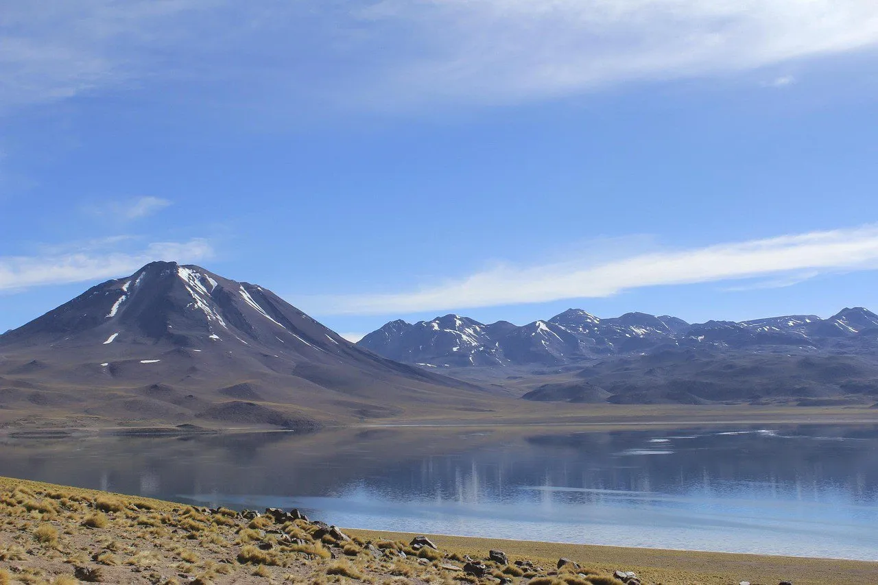 9
Away from San Pedro, the Miscanti and Miñiques lagoons bring together blue water, low vegetation and mountains on a high-altitude circuit with access control in Socaire.
View details for Altiplanic Lagoons: Miscanti and Miñiques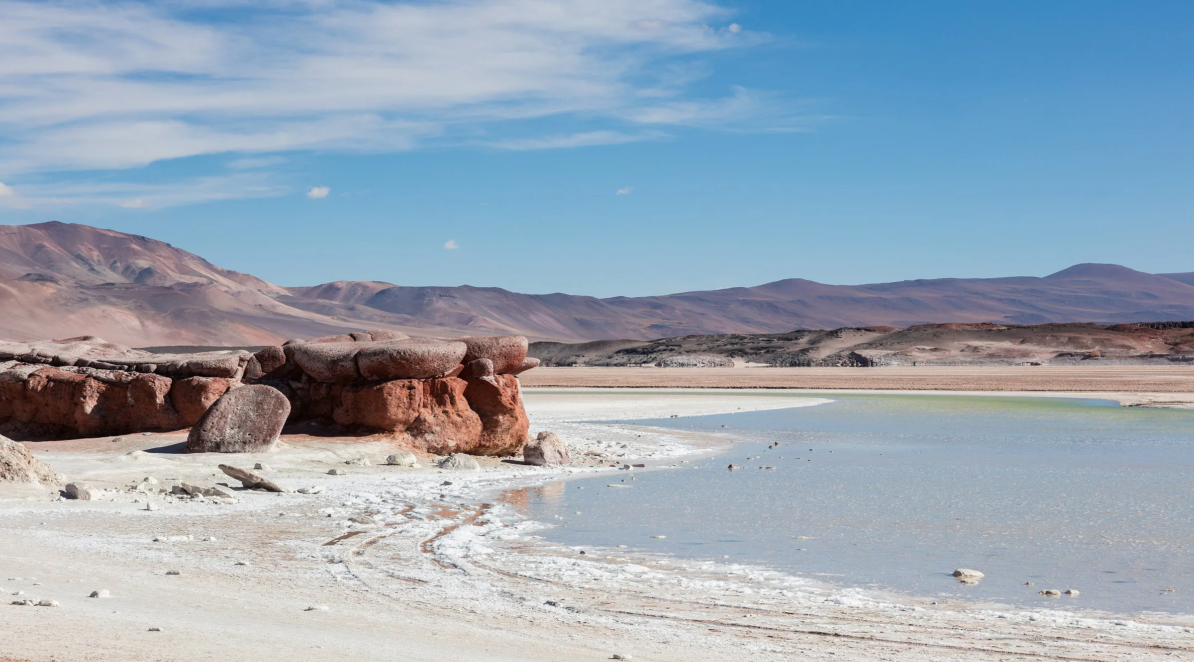 10
The reddish rocks of Piedras Rojas meet saline waters on the Socaire altiplano, on a long excursion from San Pedro de Atacama.
View details for Piedras Rojas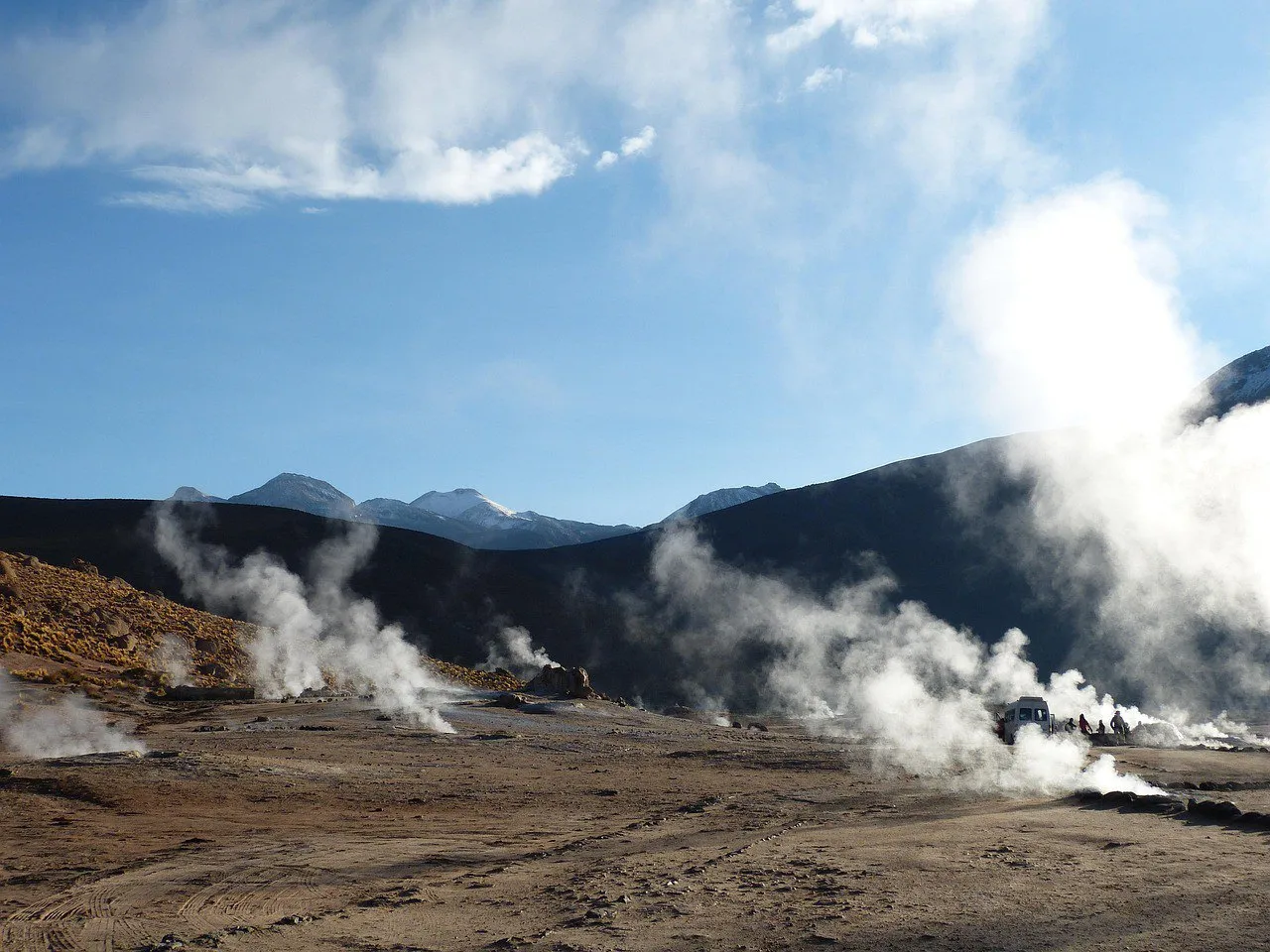 11
On the altiplano north of San Pedro, the Tatio geothermal field shows columns of steam in the cold morning and demands a pre-dawn start and attention to the path.
View details for El Tatio Geysers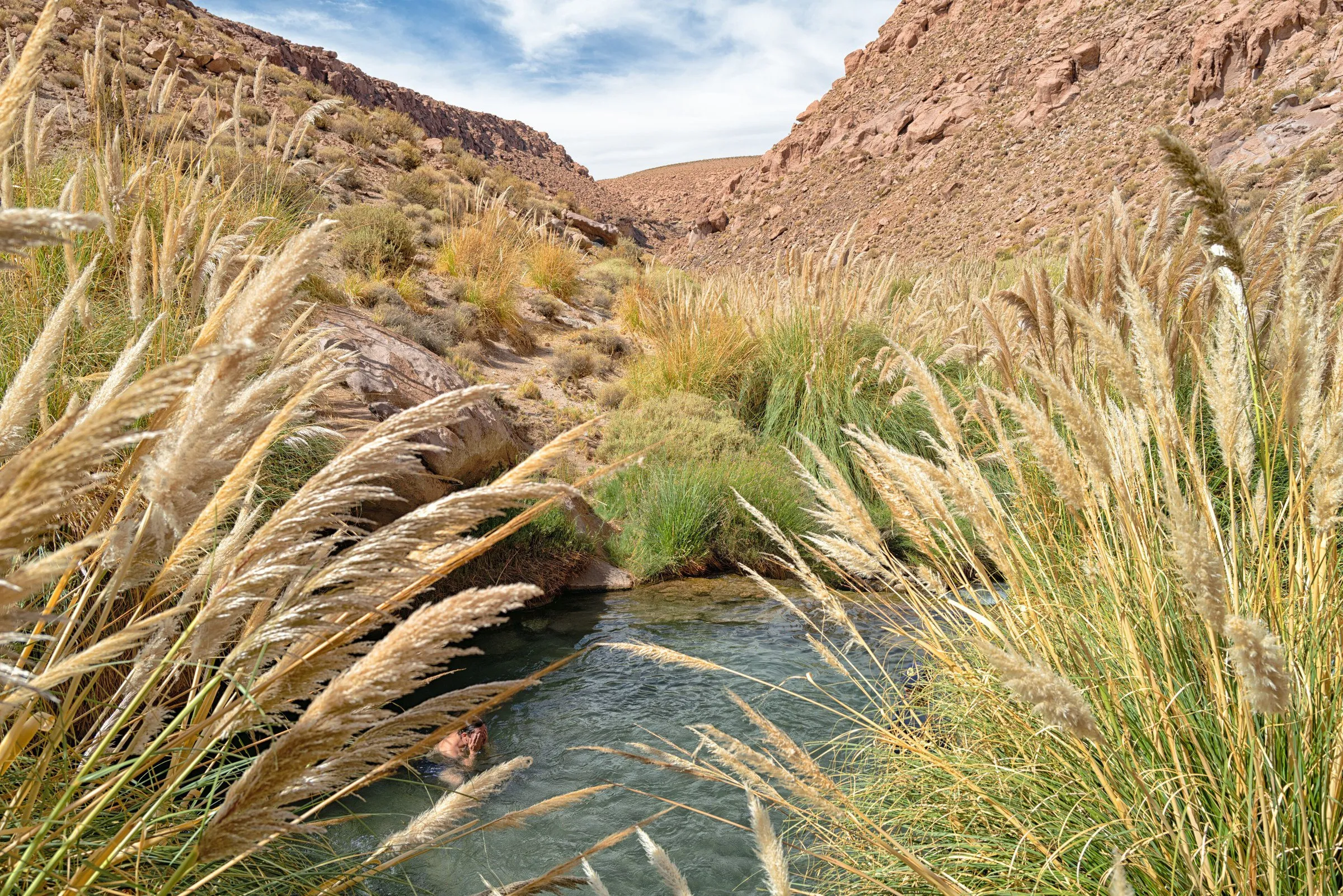 12
Outside the village, the Puritama thermal pools follow the course of a river inside a gorge, with walkways and visits organized in shifts.
View details for Puritama Hot Springs1The church's light facade matches the scale of San Pedro's low houses. Next to the square, the stone and adobe temple is a good first stop for taking in the village calmly, before you start counting how many tours still fit on the calendar.
Notice the building materials and the contrast between the light exterior and the shade inside. The visit is urban and can be done on foot; if there is a service or the interior is closed, enjoy the surroundings without treating religious routine as an obstacle to the itinerary.
2Reddish stones climb the hillside in walls and enclosures that help you imagine the work of defending and organizing life in this territory. The Pukará de Quitor is a pre-Inca fortress, linked to the Atacameño communities, with spaces that served as dwellings and storage.
It lies in the surroundings north of San Pedro, close enough for a short outing, but with walking and sun exposure. Arrange the trip with local transport and follow only the parts open to visitors; an ancient ruin does not need a contribution from the soles of your shoes.
3The Valle de la Luna lies outside the village, in the Cordillera de la Sal, and swaps adobe walls for sharp ridges, dunes and whitish surfaces. Walking through the authorized sectors reveals textures that, seen from the car, looked like just another brown hill.
It is a half-day round trip, usually organized with transport from San Pedro. Late-day light tends to bring out the tones of the mountains, but the plan depends on access routes and a reserved ticket. Check the circuit before choosing your spot to wait for the sun to sink.
4In Toconao, the bell tower stands apart from the San Lucas church, giving the square an arrangement worth a stroll. The village lies outside San Pedro, on the edge of the Salar de Atacama, and shows that a desert can have an orchard too.
Fit the visit into the round trip to Chaxa, with arranged transport and time to take in the architecture without stopping just for a photo. The craft shops can lead to a chat about stonework; ask before taking photos and check whether the church is open.
5At Laguna Chaxa, the landscape stays close to the ground: irregular slabs of salt, shallow water and birds feeding. The flamingos give scale to a scene that seems still, until you notice the movement of beaks and legs in the water.
Tourist access is in the Soncor sector of the Los Flamencos National Reserve, on the territory of the Toconao community. It is an outing from San Pedro that pairs well with the neighboring village; arrange transport and tickets before you leave. The birds' distance varies, so bring patience and stay on the marked path.
6Baltinache seems to have packed its whole palette into two colors: turquoise water and pale salt edges. The small lagoons lie outside the urban area, in an open landscape that calls for walking along permitted paths and a pause to compare each pool.
The round trip leaves San Pedro and includes a dirt stretch across the Llano de la Paciencia; hire transport suited to the route. Plan the visit around the scenery: the operator consulted reports a swimming suspension so the ecosystem can recover. Check conditions with the administration and do not count on getting in the water.
7The names often get mixed up in tour-shop windows, but it is worth getting the caption right: Cejar is for looking; neighboring Piedra is the lagoon the administration has enabled for swimming. The area lies outside the village, on the Salar de Atacama, under the care of the Solor community.
The trip from San Pedro can combine the lagoons with Tebenquiche, if tickets and schedules allow. Anyone who wants to get into Piedra must follow the restrictions on time spent and on products on the skin. The ticket does not turn every lagoon into a pool: follow the signs on site and protect the banks.
8Tebenquiche stretches the horizon between brackish water and salt edges. When the surface and the wind cooperate, the sky appears near your feet too. It is a lagoon of the Salar de Atacama, outside the village of San Pedro, and the visit works best without rushing to find the perfect reflection.
Combine the transport with the Cejar and Piedra circuit and check the last access time before planning photos at the end of the day. The place is for contemplation, not swimming; stay in the marked areas and leave salt and stones where they are. Here, a souvenir works better on your memory card.
9Miscanti and Miñiques offer a deep blue surrounded by mountains and low vegetation. Both lagoons belong to the Los Flamencos National Reserve, in the territory of Socaire, and call for a different pace from an urban outing: walk slowly and let your eyes do the most intense part of the work.
From San Pedro, set aside a full day for the circuit, often combined with Piedras Rojas. The administration requires a reservation and check-in in Socaire before access; do not drive straight to the lagoons expecting to sort everything out at the gate. Snow and storms can interrupt the visit, even with the plan ready.
10At Piedras Rojas, the reddish shore changes the shape of the landscape before the eye reaches the saline water and the mountains. The area, run by the Socaire community as the Salar de Aguas Calientes Sur, lies far from the village of San Pedro and is part of the long altiplano outings.
Combine it with Miscanti and Miñiques only on a full-day circuit, with entry times coordinated. The approach and the walk depend on the conditions allowed by the administration; stay on the authorized route. The photo happens right from there, without climbing on formations or crossing fragile areas to improve the angle.
11At Tatio, the cold pre-dawn lets the steam stand out against the mountains. The geothermal field lies on the altiplano north of San Pedro, at high altitude, with fumaroles and hot-water vents that should be viewed from the authorized routes.
The tour usually leaves in the dark, taking the mountain road to arrive at sunrise. It is a round trip, but it takes up the morning and steals part of the night before: plan a quiet afternoon afterward. Go with transport prepared for the route and follow local instructions; getting close to the water to test the temperature is not on the program.
12The warm water of Puritama runs through a gorge, among vegetation and pools linked by walkways. After so much salt and stone, the sound of the river changes the soundtrack of the trip. The springs lie north of San Pedro and are a half-day outing, returning to the same base.
Book a ticket for the shift you want and arrange transport along the Guatín route. Access to the pools has its own rules: visiting the conservation reserve by another path is not the same as a ticket for bathing. Bring a swimsuit and respect the open areas, without looking for an alternative pool outside the circuit.
The usual way in is through El Loa airport, followed by a road transfer to San Pedro. Allow about an hour and a half for this stretch and arrange transport before the flight; the six days of the itinerary begin after arrival.
Check whether the agency includes tickets and check-in. Miscanti, Miñiques and Piedras Rojas require a reservation and passage through the checkpoint in Socaire; other places have their own administrators and rules. Compare the total price, with entrance fees and meals, before booking.
Leave Tatio and the Socaire circuit for after the lower-lying tours and adjust the pace to your body. This order is a planning suggestion, not a guarantee of acclimatization; seek professional advice if altitude is a concern for you.
The contrast between sun and cold pre-dawn calls for layers, a hat, sun protection and water. From December to March, the rains of the so-called altiplanic winter can affect roads and tours; check conditions close to the trip and accept changing the order of the days.
Respect the authorized circuits, residents' privacy and the administrators' guidelines. Do not collect salt or stones, do not enter the lagoons on your own, and ask permission before photographing people; the landscape is also lived-in territory.
Bring Chilean pesos for small purchases and confirm the payment methods for each ticket. If you rent a car, check fuel, tires, road conditions and insurance coverage for the routes you choose; do not improvise a route because it looks short on the map.
After a morning of wind and road, a hot dish is a bigger hit than any speech about cuisine. Atacameño cooking shows up in the products and dishes of the communities: in Socaire, for example, there are dishes of corn, quinoa and lamb or llama meat. Ask where the ingredients come from and what is available that day; trying this food also helps take the trip out of a frame made only of volcanoes and lagoons.
An Andean corn stew with meat, which may include lamb or llama; in Socaire, the dish is advertised as patascka.
Cooked fluffy and served with sides; check for animal fat if you are looking for a vegetarian version.
Fried empanadas with potato and lamb or llama meat: a preparation tied to the Socaire community.